How to Set-up Gibson Ridge Level 2 Analyst Radar Software
by cyclonewxchick in Workshop > Science
35502 Views, 21 Favorites, 0 Comments
How to Set-up Gibson Ridge Level 2 Analyst Radar Software
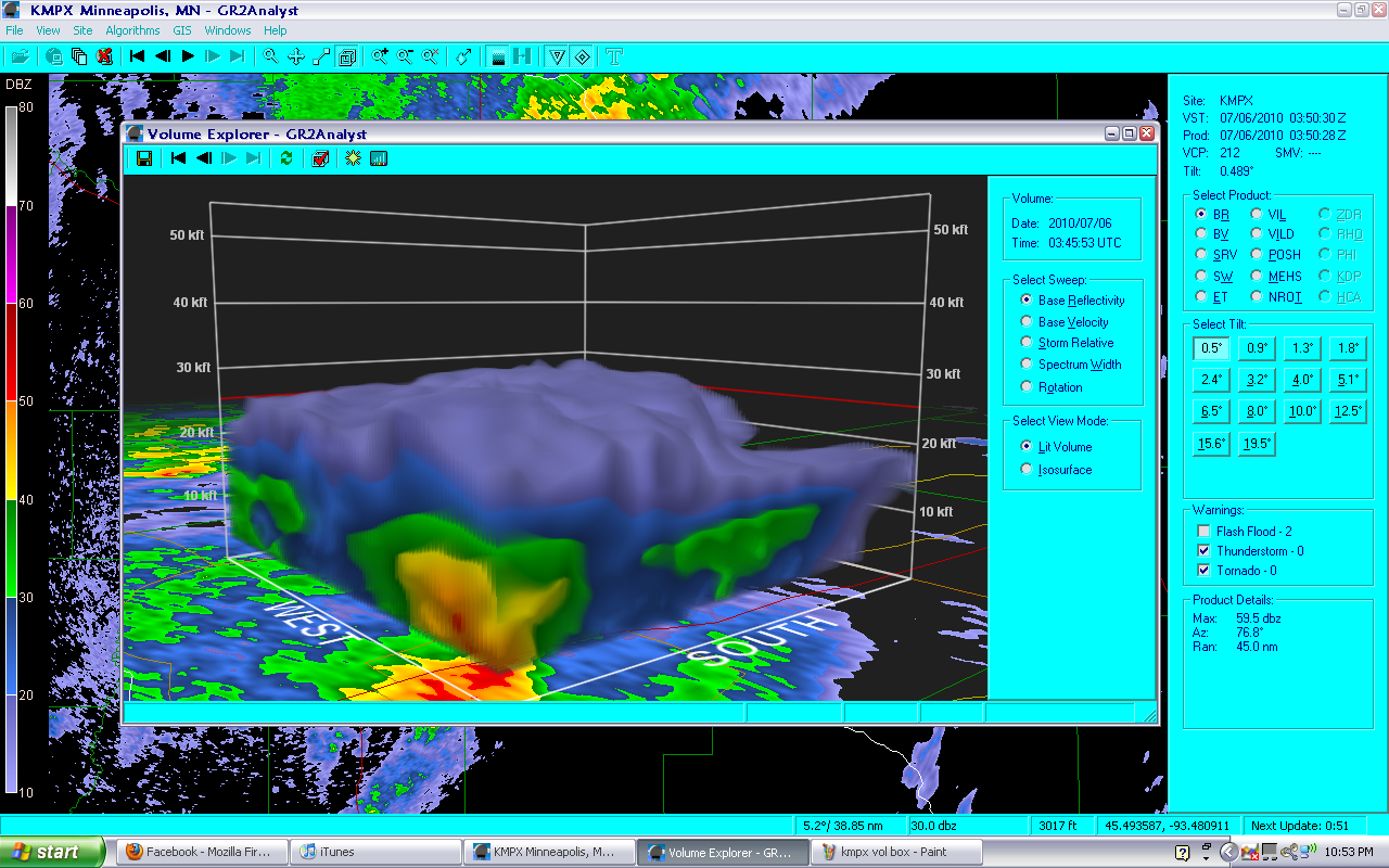
With the popularity of storm-chasing and interests in severe weather on the rise, more people have the ability to access more weather information faster than ever before with more details available to them. Gibson Ridge is one of the leading radar software brands that make radar data available to the public! These instructions will help you set up your software so that you can use it in the comfort of your home and you can look at radar data whenever you want to, not when the meteorologist on TV decides you get to.
These instructions will guide you through the initial set up of the software. The initial set up includes; entering polling data, starting the archiver, and adding placefiles. With the set up of these three elements of the program, you can begin to explore the program on your own.
Real time data is downloaded right onto your computer screen within minutes of being observed in the atmosphere by the radar, usually a WSR-88D. Severe weather watches and warnings will load quickly in conjunction with the radar data, allowing you to access more information about a particular storm.
.
Italic paragraphs or sentences will not be instructions, but they will offer simple trouble-shooting and tips along the way while you are setting up your new software.
These instructions will not be able to help in a weather emergency, please trust the professional meteorologists to relay important information to you.
If, while using this program, severe weather comes your way, turn on your NOAA Weather Radio, your TV, or your local radio station and pay attention to warnings and seek shelter in a basement, an interior room, or a room without windows.
Download Gibson Ridge Level 2 Analyst
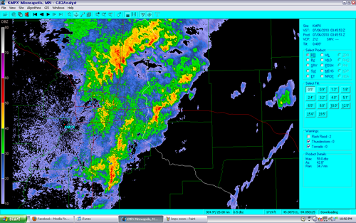
As long as you are viewing these instructions, you might as well give the program a try!
Download the program from http://grlevelx.com/gr2analyst/
Scroll about halfway down the page once you reach downloads and click on GR2Analyst_Setup. This will start the download as well as your 21-day free trial for the program.
Download the program from http://grlevelx.com/gr2analyst/
Scroll about halfway down the page once you reach downloads and click on GR2Analyst_Setup. This will start the download as well as your 21-day free trial for the program.
Navigating to Your Closest Radar Through the Software
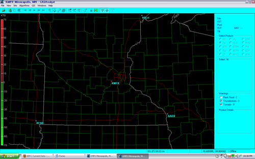
Navigate to the radar closest to your home by clicking the dot above the radar site name.
You may have to do this several as GR does not show the all the radars in the nation at once.
Once you get to your desired radar, it will be centered in your GR window.
You may have to do this several as GR does not show the all the radars in the nation at once.
Once you get to your desired radar, it will be centered in your GR window.
Configure Polling
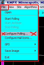
Under FILE click on CONFIGURE POLLING...
Once you are at your desired radar site, you need to tell the program where it needs to draw the data from.
Once you are at your desired radar site, you need to tell the program where it needs to draw the data from.
Configure Polling Part 2
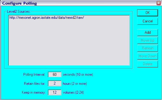
A window will pop up. If you have not used GR before, then the window will not have any text in it.
Click on ADD in this window.
Click on ADD in this window.
Configure Polling Part 3, You're Almost Able to See Data!!!

In the window that pops up, enter the website where you will be getting data from.
A lot of times, this information is available at a cost, but with the Iowa Environmental Mesonet website, this information is free.
http://mesonet.agron.iastate.edu/current/radar.phtml
Under Raw data on the mesonet website, right click on Level2 NEXRAD Data and select COPY LINK LOCATION. DO NOT LEFT CLICK ON THIS LINK.
Paste the copied link (Level2 NEXRAD Data) into the Enter Polling Directory window and click OK
Start Polling!!!
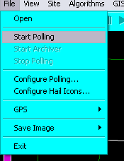
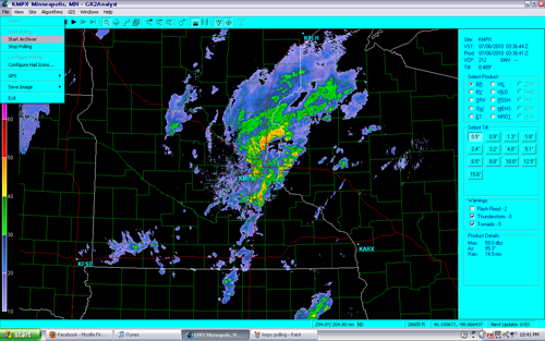
Under FILE again, left click on START POLLING. After a few moments, a radar image should pop up!
If an image does not pop up, double check your internet connection, make sure it is on and is working properly. Any internet connection is required for the program to show current data. If you are still having problems viewing data visit www.grlevelx.com.
If an image does not pop up, double check your internet connection, make sure it is on and is working properly. Any internet connection is required for the program to show current data. If you are still having problems viewing data visit www.grlevelx.com.
Retrieve Previous Data
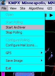
Under File, left click on Archived Data.
This will retrieve up to an hour and a half of data that was taken before you opened up your GR software.
This is useful when there is severe weather that has been going on for a while and you decide to open up GR in the middle of a weather event.
This will retrieve up to an hour and a half of data that was taken before you opened up your GR software.
This is useful when there is severe weather that has been going on for a while and you decide to open up GR in the middle of a weather event.
Adding Placefiles
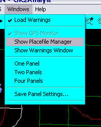
Under the WINDOWS tab, Click on SHOW PLACEFILE MANAGER.
Placefiles are files that you can add to GR that will show different data on the screen along with the radar data such as; Spotter Network members and their locations, statewide METARS, Mesoscale discussions, and severe weather watches.
Placefiles are files that you can add to GR that will show different data on the screen along with the radar data such as; Spotter Network members and their locations, statewide METARS, Mesoscale discussions, and severe weather watches.
Adding Placefiles Part 2

To add placefiles, click on the FOLDER ICON in the window that just opened up.
Adding Placefiles Part 3; You're Almost Done Adding Placefiles!
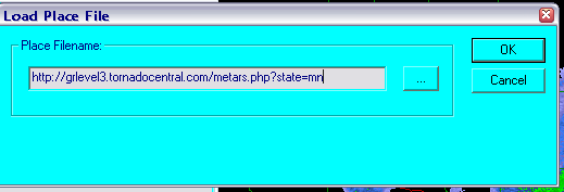
In the new window, add the source of the placefile data.
Again, the Iowa Environmental Mesonet is an excellent source of free placefiles that are available to everyone. There are a number of sites like this available on the internet, I'm just showing you which ones I use and why I prefer them. If you want, there are a number of sites that require you to pay to use their placefiles and some of the sites have excellent files. I'm just a broke college student :)
http://mesonet.agron.iastate.edu/request/grx/
When you find a placefile you would like to add, right click over the bolded name of the placefile and select COPY LINK LOCATION. Paste the location into the Load Place File window and click OK.
Repeat this step as many times you have need for.
Adding Placefiles Part 4; You're Done With Loading Placefiles!
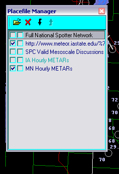
After adding all the placefiles you desire, you can turn them on and off by clicking on the leftmost box in the row of the placefile name.
Turning placefiles on and off may seem weird for now, but when you do not have the screen zoomed in to one particular storm or county, it is very confusing looking at a screen littered with the names of people who are stormchasing and hourly METARs. Turn on placefiles only when it is not going to clutter the screen and obscure the storm that you are trying to view.
Turning placefiles on and off may seem weird for now, but when you do not have the screen zoomed in to one particular storm or county, it is very confusing looking at a screen littered with the names of people who are stormchasing and hourly METARs. Turn on placefiles only when it is not going to clutter the screen and obscure the storm that you are trying to view.
Begin Exploring the Software on Your Own!
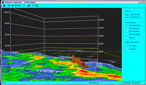
Gibson Ridge has so many elements that I cannot cover all of them, feel free to post any questions and I will be glad to help!
Help and FAQs can also be found on the GR website, www.grlevelx.com.