Geographical Quiz Sheets for Your E-Quiz
by heutnoch in Living > Education
515 Views, 0 Favorites, 0 Comments
Geographical Quiz Sheets for Your E-Quiz
I described how I built my first Electronic Quiz and of courses my siblings and I made tons of quiz sheets, which were fun projects in themselves. We made quizzes about flags, about how far animals can jump, some nearly impossible quizzes about knowing countries by shape. We went to the library to search through the books for good pictures and scanned in Concentration cards. And for some reason we made a lot of maps where you have to find the cities. Here I will show you how we did it - from the humble beginnings to the more recent and fancy ones.
Yes, the newer ones might look prettier, but if you have young children they might have more fun creating there own maps with marker pen on sandwich paper.
Supplies
Drawn maps:
- marker pen
- sandwich paper
- atlas
- scanner
- some office program (e.g. Word, PowerPoint)
- printer
Edited maps:
- Google Earth (or Marble)
- GIMP (is what I used)
- some office program
- printer
Draw a Map on Sandwich Paper
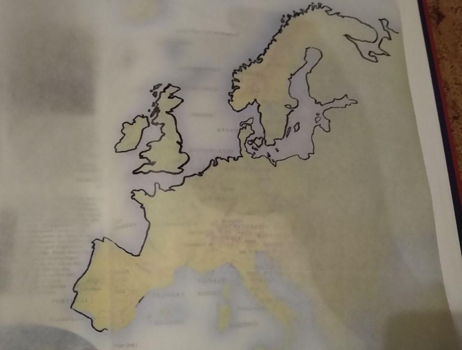
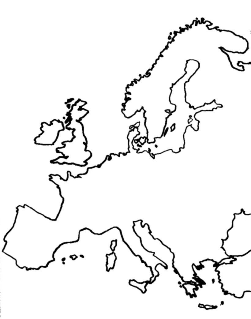
You can find great maps in your school atlas, but editing all the city names out would be quite the task. So just put some see-through sandwich paper on the map, maybe hold it in place with some weights or some not to sticky tape, you can pull of later without damaging the atlas pages, and follow the outlines with a marker pen.
Now you can scan the result in. I used the grey scale setting and got a real black white picture with the threshold in gimp. So I could fine-tune a bit. Afterwards I let run a tiny 2x2 Gaussian blur over the image to get it less pixelated. This way even younger children can help with creating the maps - things you made yourself are always a little nicer - and even our first monochrome printer could print those.
Times changed so you can do some colouring ahead of scanning or while editing, if you want.
Create a Map With Google Earth and GIMP

We where lucky enough to have parents, who understood how desperately we were in need of a colour printer. So our maps changed soon.
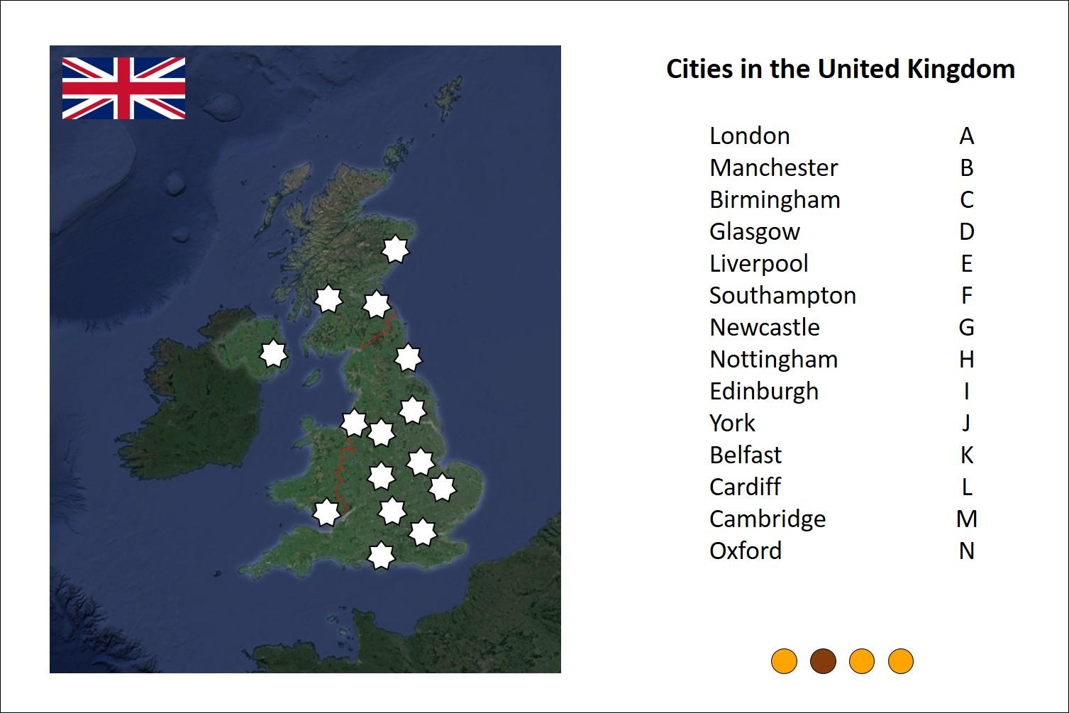
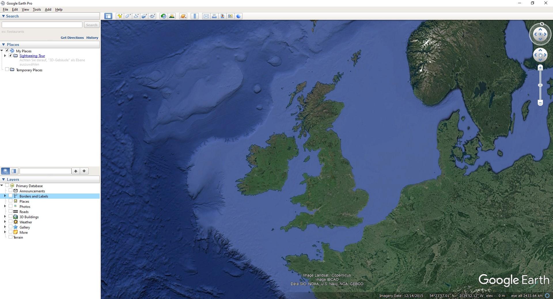
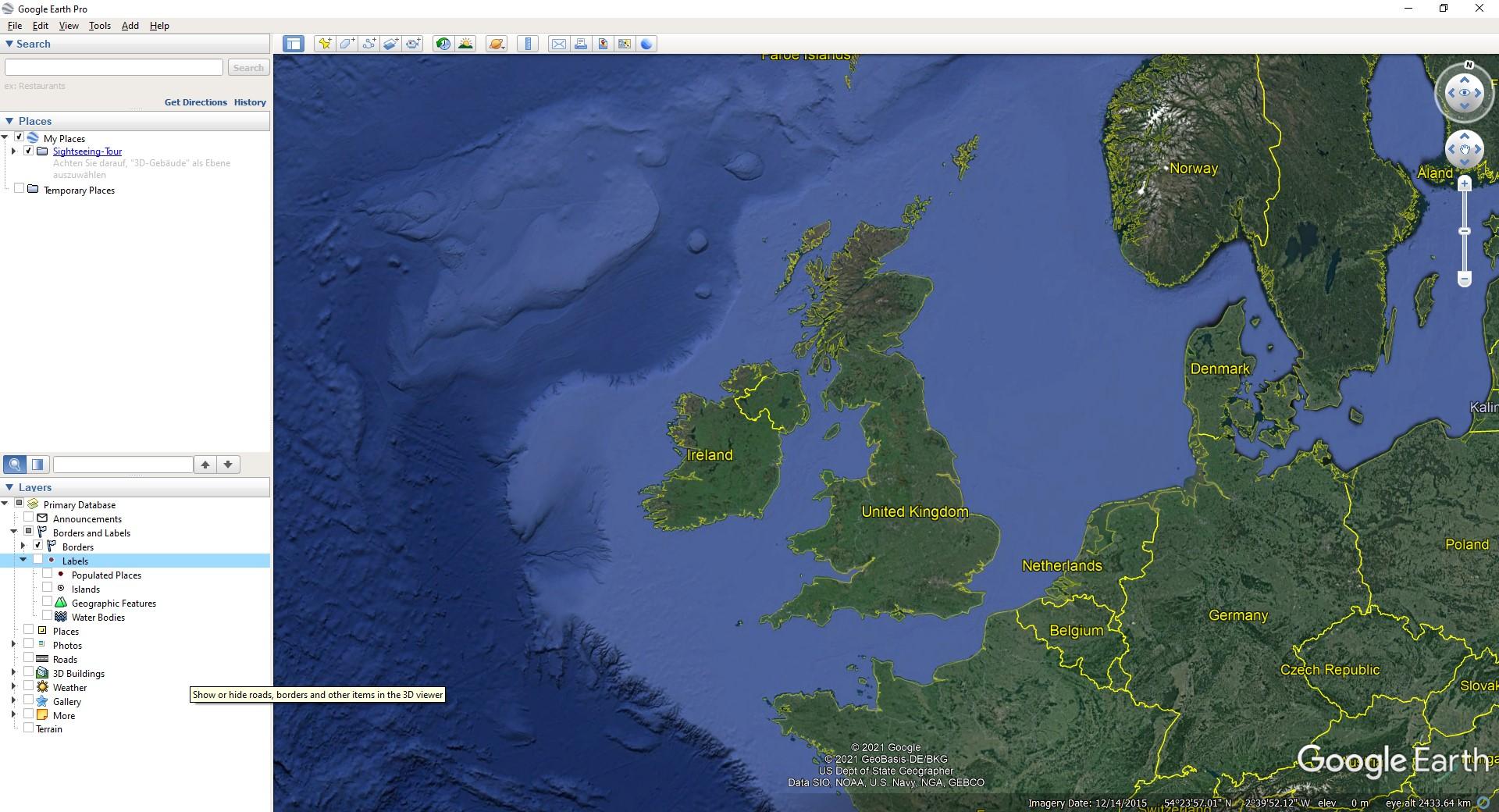
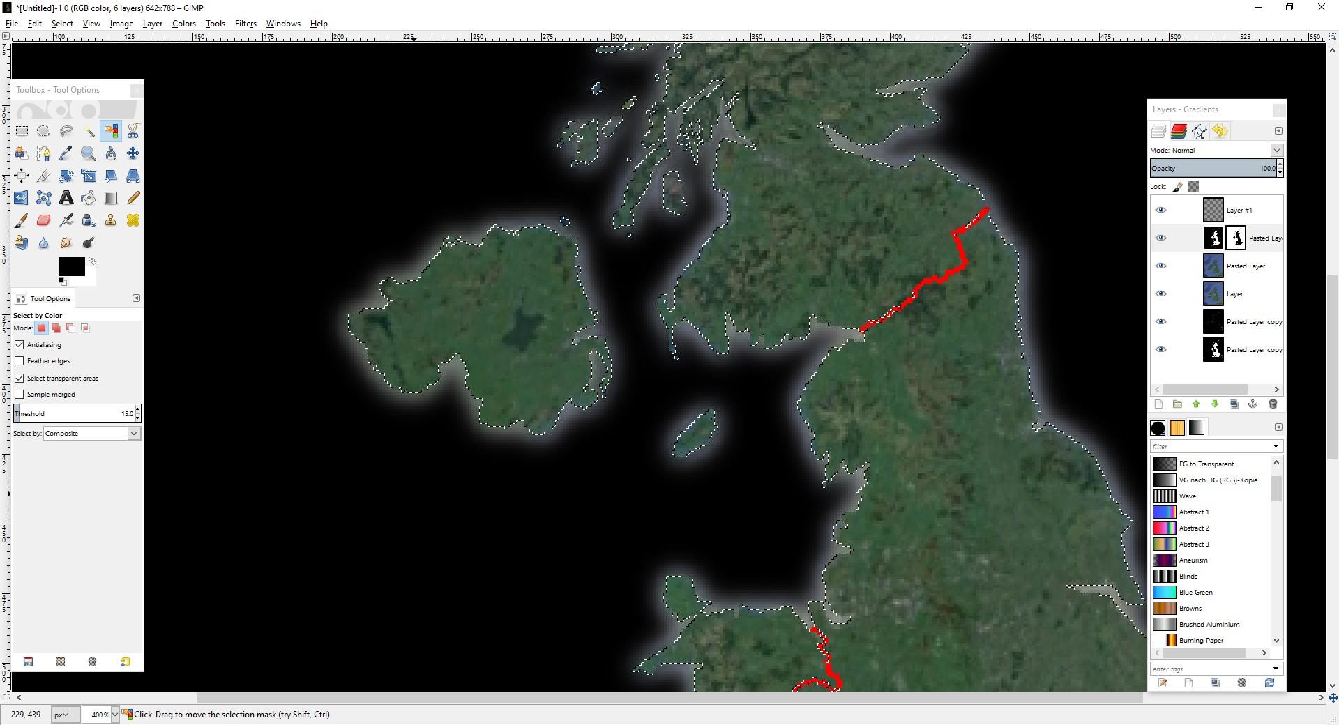
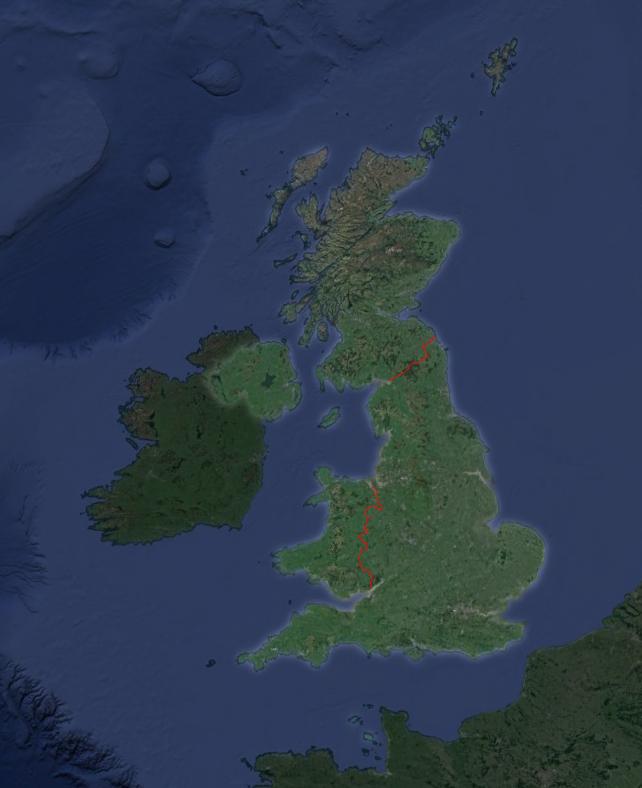
I know that I did this a few years ago using Marble and I liked the atlas like look but yesterday not all maps loaded so I switched to Google Earth. I decided to create a map of the UK. So I just zoomed in and made two screenshots. The first one with all labels of boarders unchecked, the second with boarders only. It also shows the name of the countries, but that's not to much of a bother.
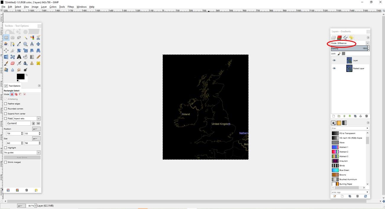
You need two layers of the map without boarders and a layer with boarders in GIMP. First I trimmed the image down to the part I really need. Why would I bother to edit the rest? Then I set the option of the top layer with boarders to difference and merged it to the layer below - one of the layers without boarders. Now I got a black picture with only the boarders (and names of the countries) showing.
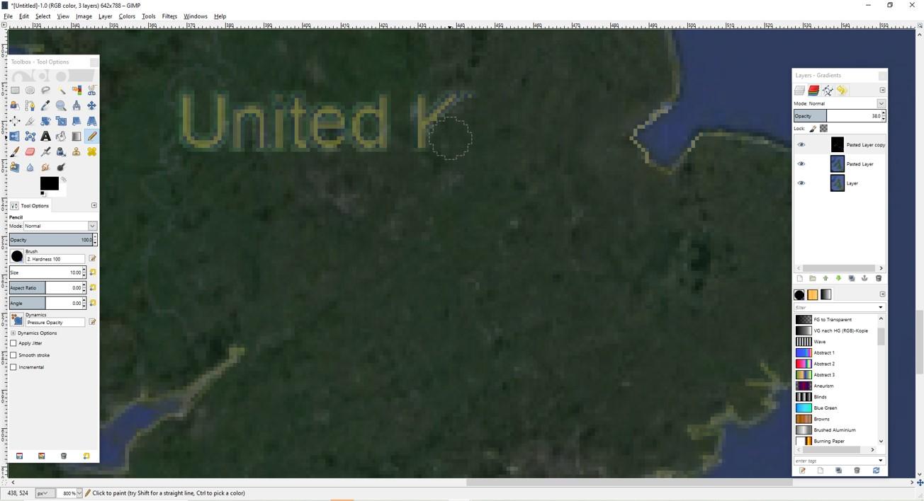
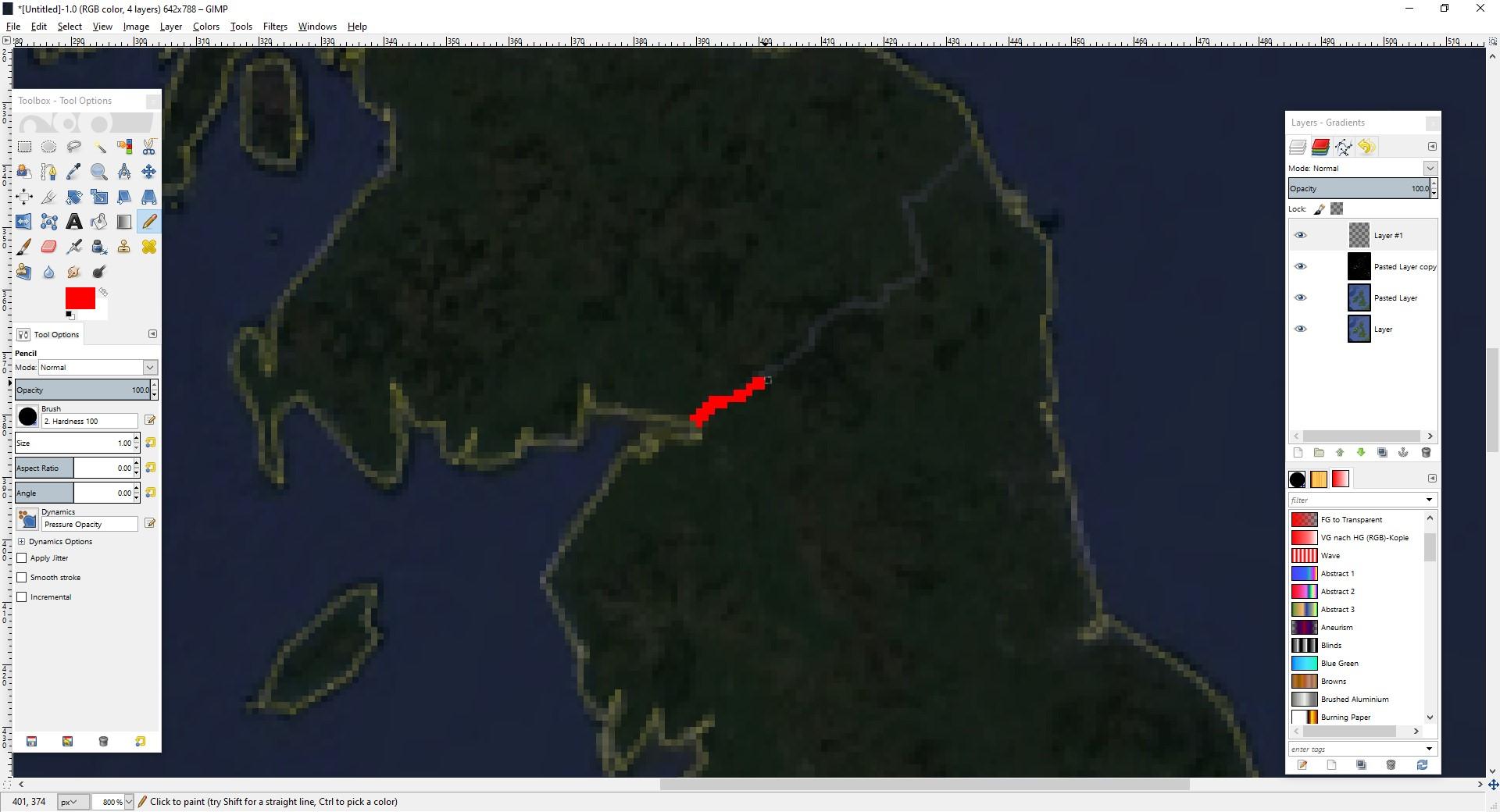
I got rid of the name labels with a black pen and redrew the now missing piece of boarder along the coast line. I lowered the opacity setting until I could see the coast line to do so. Then I created a transparent layer and retraced the inland boarders to Scotland and Wales by hand using a bright red colour. The boarder to Wales was also "damaged" by the "United Kingdom"-label and for some reason not entirely closed in the south so I looked at a map to get it somewhat right.
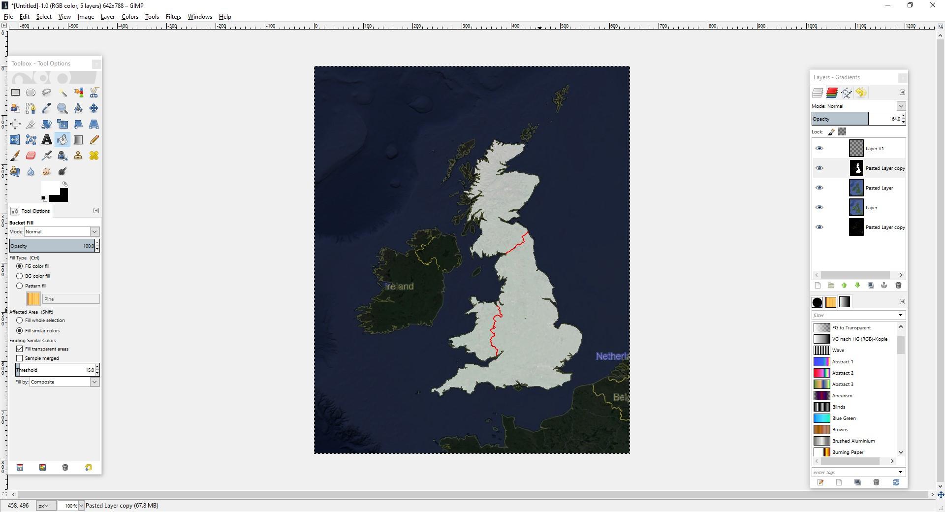
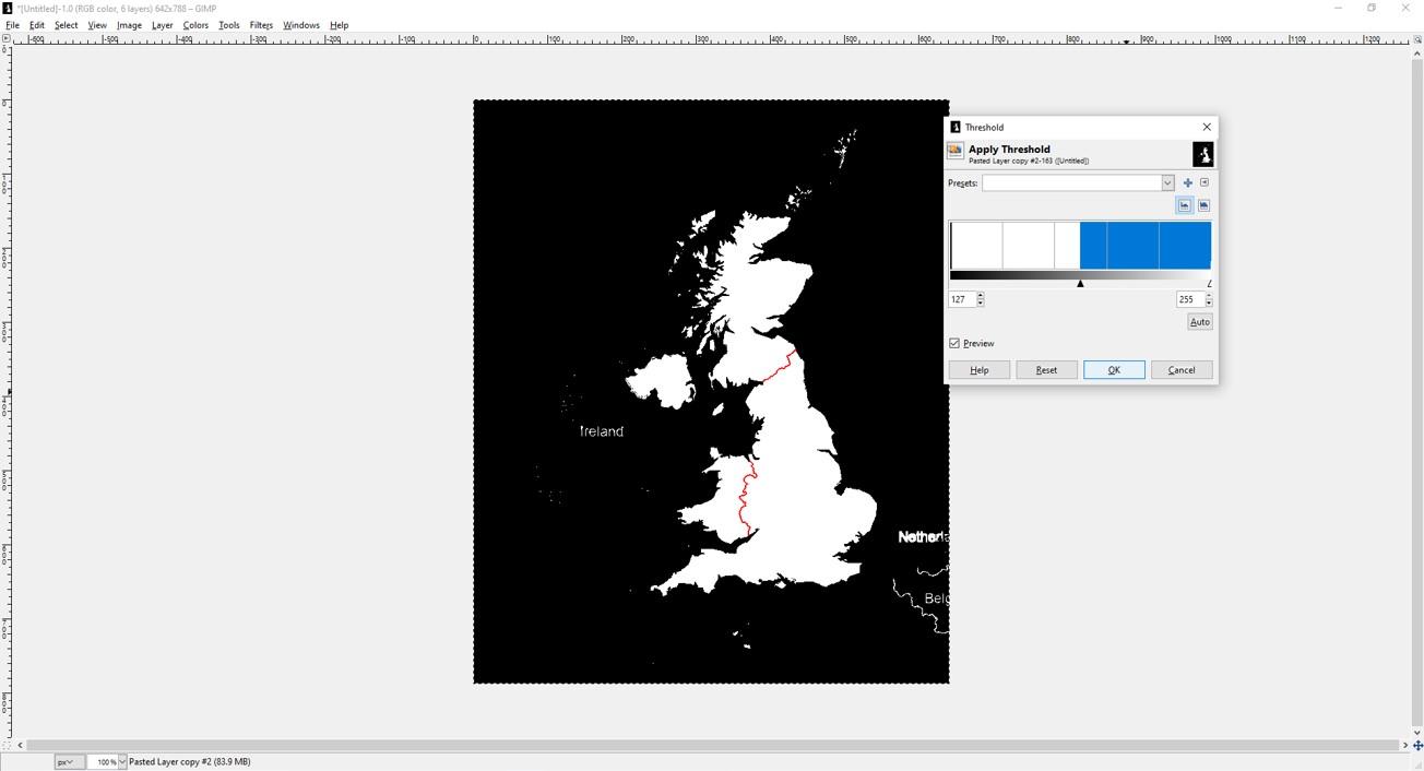
Next I filled everything, that belongs to the UK with white colour on my layer with all the boarders. This Layer will be our mask. I just needed to change it fully to black and white using the threshold and it was almost done. Some white dots and names of surrounding countries had still to be blackened.
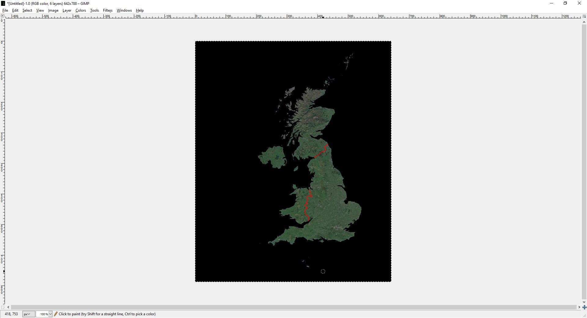
Now I set the opacity back to 100% and the colour white to transparent and only the UK showed as intended. I selected everything outside of the UK by colour (easy, as it was all black) and let run a 15x15 Gaussian blur over the layer mask. This gave me the bright halo around the selected county with hard cut at the boarder, that I really like.
At last I set the black layer to a opacity of 40%. I want to highlight the UK on this map but I don't want to suppress the rest oft the world entirely. And I set the opacity of the inland boarders to 50%, because they where just too bright red.
Create the Quiz Sheets
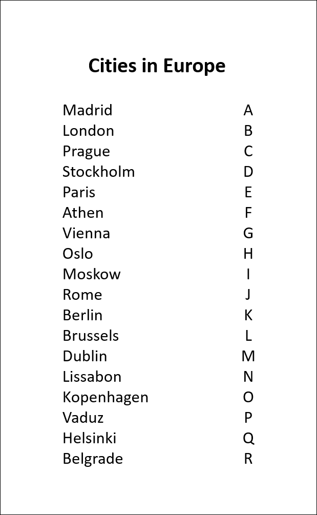
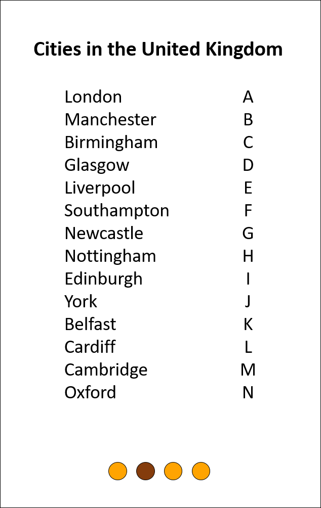

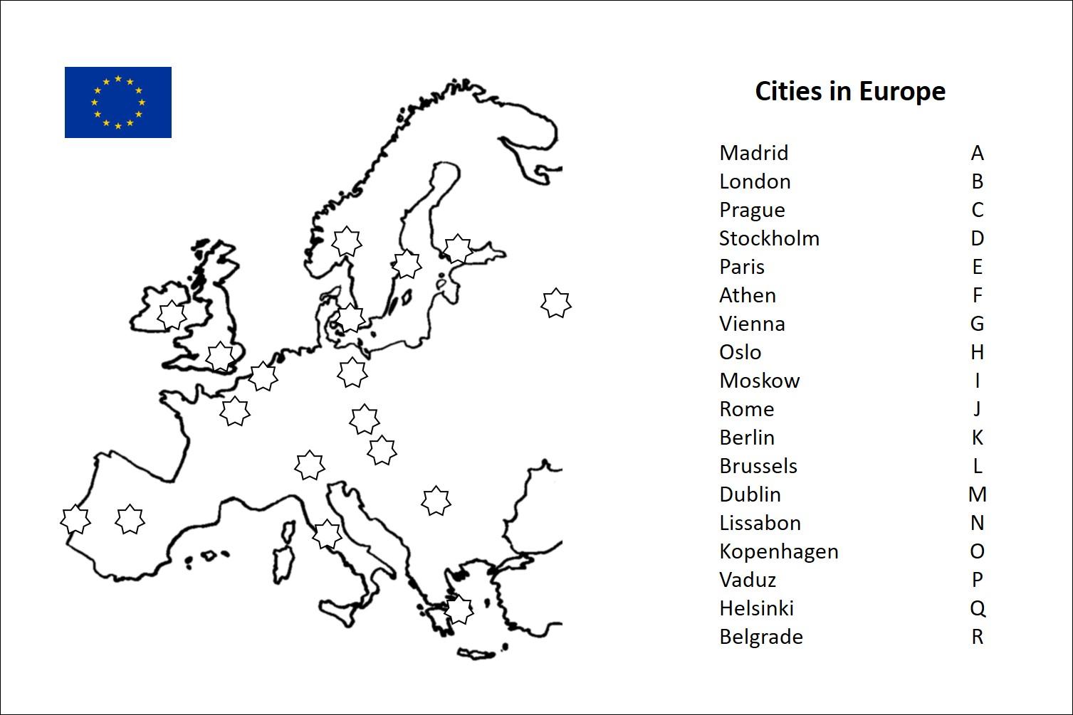
Now you can just assemble the maps and a list of city names in a office program to get a nice quiz sheet. Every name gets assigned to a letter. I just did so alphabetically in this example, but normally I do it more random to make it a little more difficult to memorize all combinations after a few quizzes. The related number shows the location of the city in the map. It is always good to have two lists of the combinations at hand, one sorted by the numbers and one by alphabet.
I like to put the numbers in little star shapes and left those empty. So you can fill in the numbers of of your secret code, if you decide to make your own electronic quiz and want to get your fist quiz sheet fast to try it out. Little flags I copied from Wikipedia, gave a nice finishing touch.
And what's up with the three round shapes below the list of cities in the UK? Now, those are meant for the upgraded version of the game, featuring 16 different encodings to make it more difficult to memorize them...