Bharat Pi Navic GPS Sensor
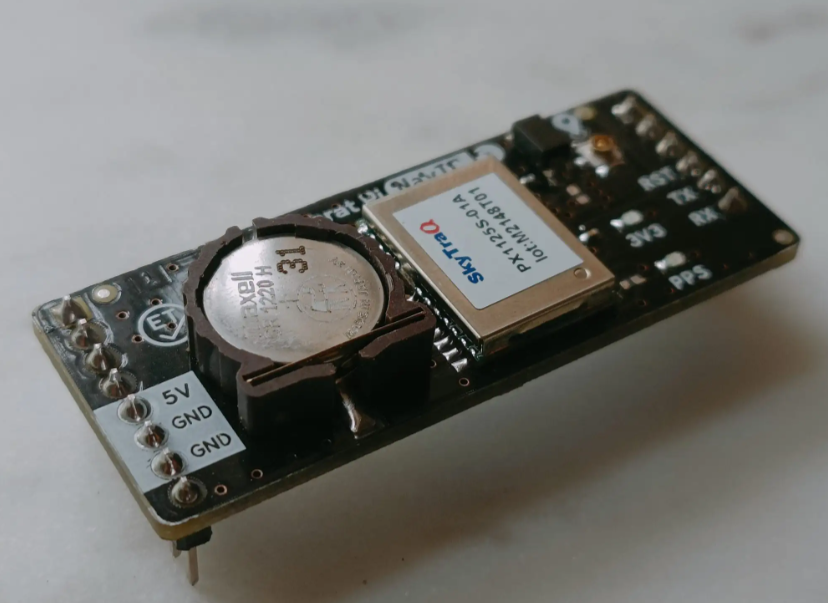
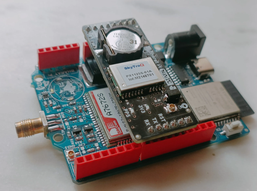
Bharat Pi NavIC is a GPS tracker module built specifically to work with Bharat Pi boards. It uses the NavIC (Navigation with Indian Constellation) system, an independent regional navigation system developed by India.
The NavIC GPS module is an add-on board that can be easily mounted on top of any Bharat Pi board. This allows you to develop tracking applications in a variety of fields, including:
- Automotive
- Healthcare
- Asset tracking
Supplies
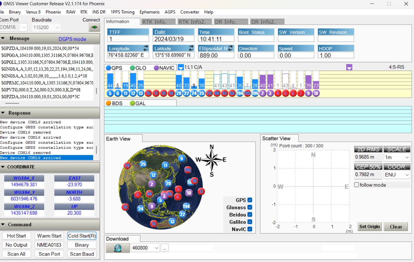
1 Download the gnss viewer customer release v2.1.174 for phoenix
http://www.navspark.com.tw/downloads
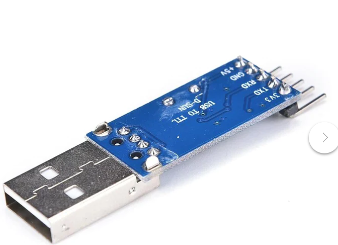
2 Usb to TTL connector
Connection
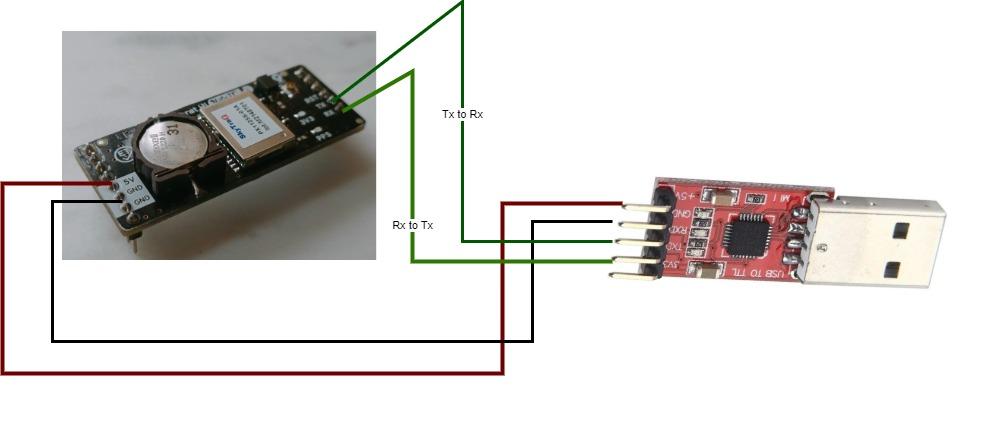.jpg)
- Connect the 5V output from the Navic board to the 5V pin of the TTL connector.
- Ground (GND) from the Navic board should be linked to the GND pin of the TTL connector.
- The transmit (TX) pin of the Navic board is to be joined with the receive (RX) pin of the TTL connector.
- Establish a connection between the receive (RX) pin of the Navic board and the transmit (TX) pin of the TTL connector.
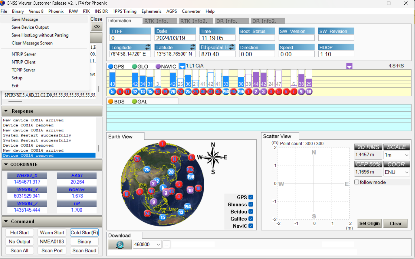
GNSS Viewer.
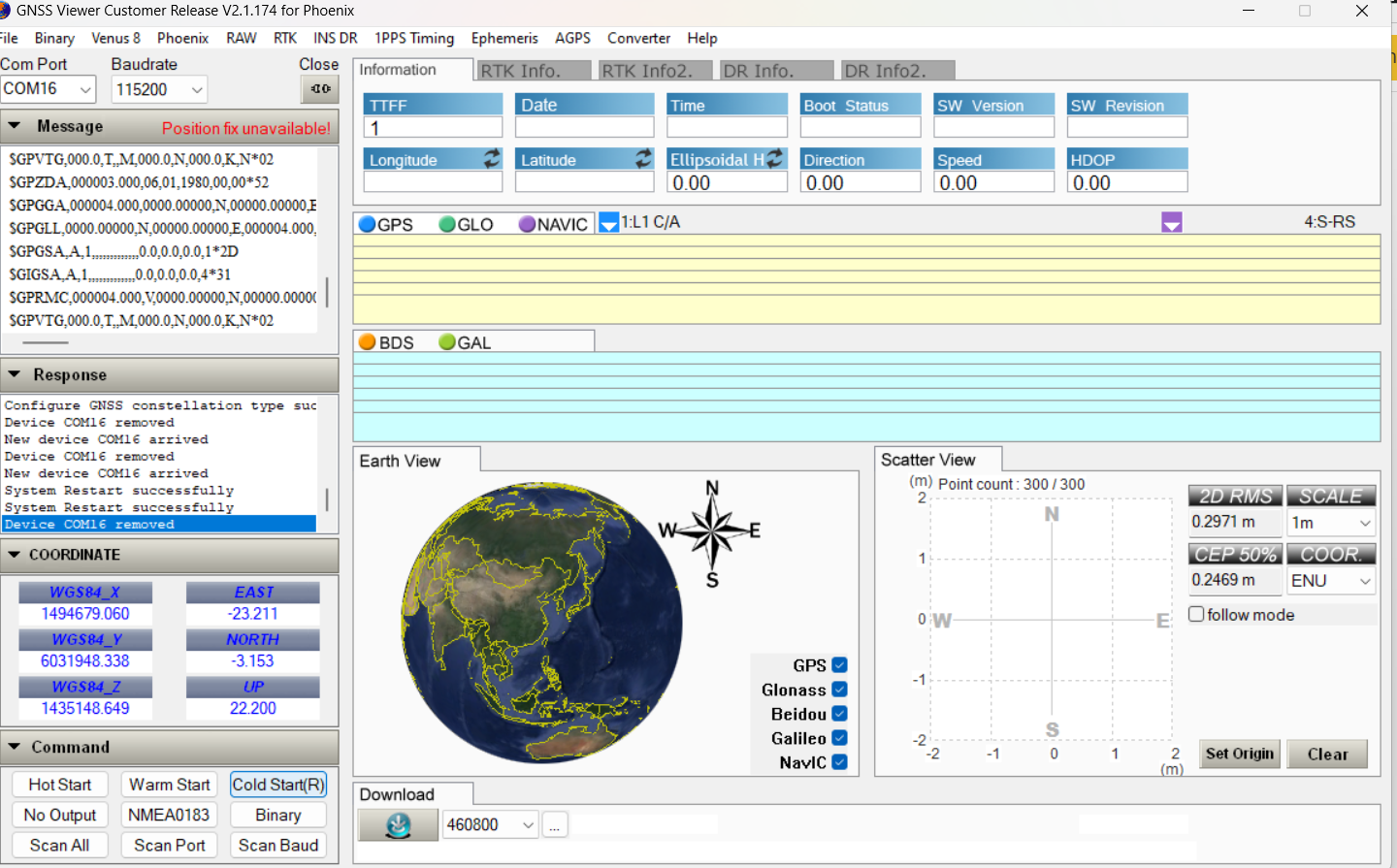
The program is designed to display information from a GNSS (Global Navigation Satellite System) receiver.
The text in the picture includes NMEA messages, which is a standard format for communicating GNSS data. The NMEA messages in the picture include information about the receiver's position, fix quality, and satellite visibility.
Connection in GNSS Viewer
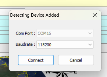
Connect the TTL connector to a computer and wait for a new window to pop up.
Ensure to check the COM port in the Device Manager.
Check With the GNSS Viewer and Save the Recordings
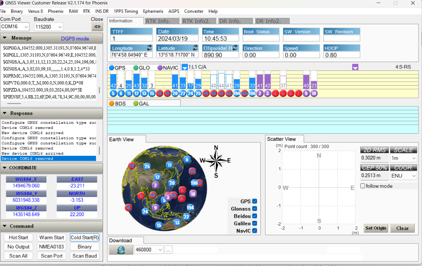
Verify the connection with the Navic GPS by checking the color coding format.
And proceed to the "File" menu, then click on "Save Message".
Storing Process
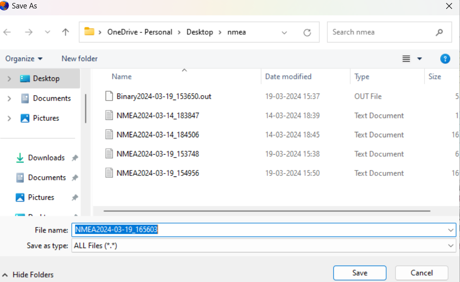

- Store the message in the NMEA format.
- Open the stored message in Notepad.
- Select the string format.
NMEA ANALYSER
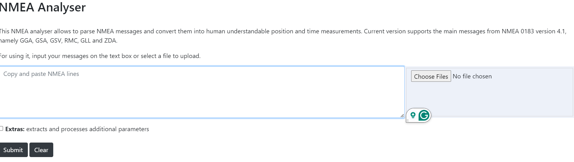
- Navigate to the website provided below.
https://swairlearn.bluecover.pt/nmea_analyser
- Insert the copied string into the specified input area.
Paste the Longitute and Latitude in the Map
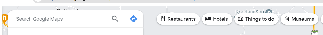
On your computer, open Google Maps.
please copy the longitude and latitude which is available in the Nmea analyser